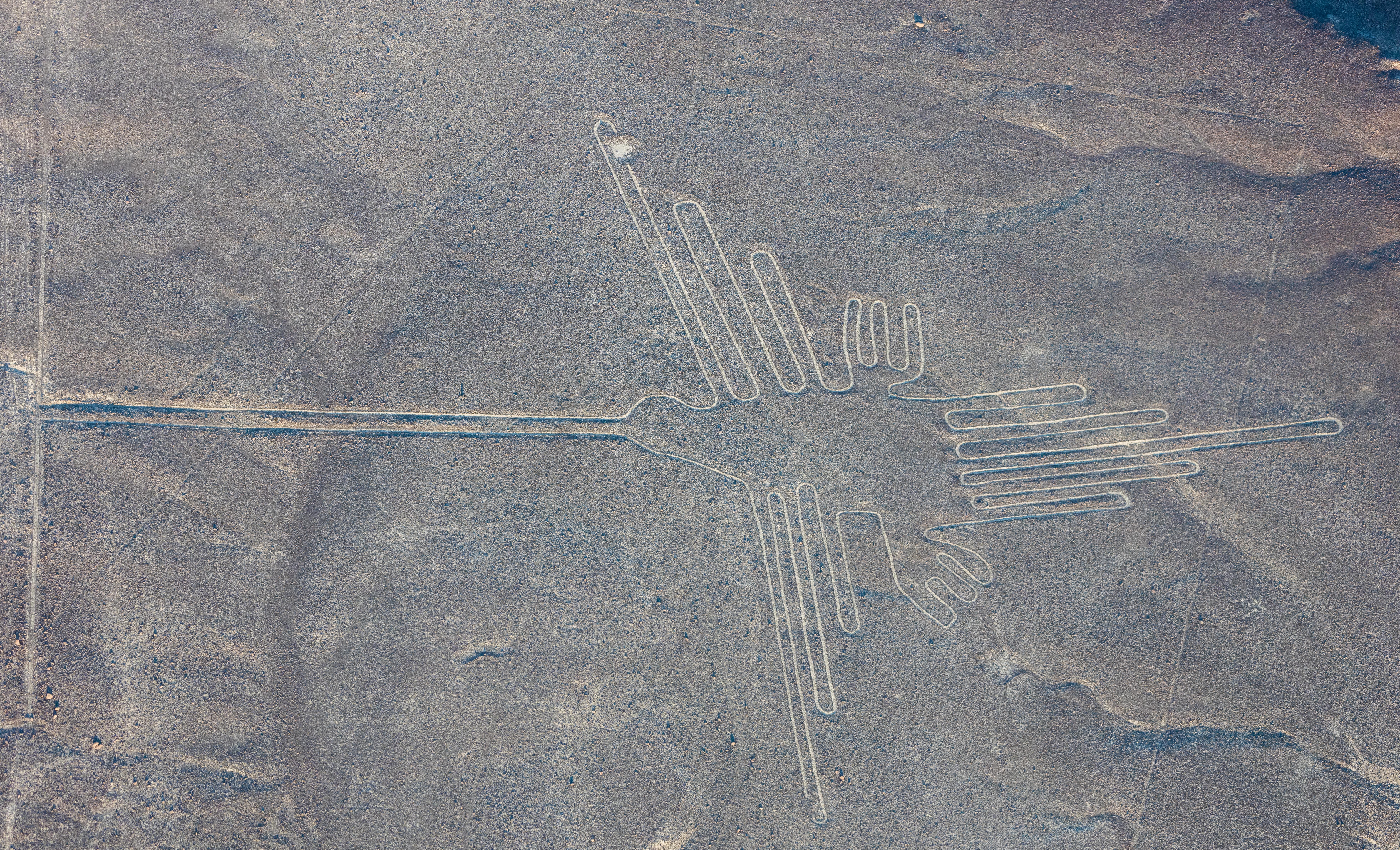
The designs survived 2,000 years because the desert lacks rain and wind. Surface pebble analysis shows the dark varnished stones were simply moved aside to expose lighter soil beneath.
Diego Delso, CC BY-SA 4.0
A climate-controlled canvas
The Nazca Lines endure thanks to a precise combination of geology and an extremely stable climate. The Nazca desert plateau is one of the driest places on Earth, receiving less than an inch of rain per year. This aridity prevents water erosion. The geoglyphs were made by removing a 10 to 15 cm layer of reddish-brown, iron-oxide-coated pebbles, known as desert varnish, to expose the lighter-colored, lime-rich subsoil.
This simple construction method has been preserved by two other important factors. First, the ground contains high levels of gypsum, which, when mixed with morning mist, hardens and helps hold the stones in place. Second, the dark surface stones absorb solar heat, creating a cushion of warm, stable air near the ground that protects the shallow trenches from the region's winds. The result is a landscape where designs, some created as early as 500 B.C., have remained undisturbed for millennia. The largest figures span up to 370 meters, with the combined length of all lines estimated to be over 1,300 kilometers.
Modern science and modern threats
The lines have survived for centuries, they are vulnerable to modern pressures. The Pan-American Highway famously cut through the tail of one lizard figure, and unauthorized vehicle traffic has caused irreversible scars on the desert floor. Informal mining operations and the expansion of agriculture also threaten the integrity of the vast site.
Changes in weather patterns, including rare but intense flooding linked to El Niño events, present a new and serious threat that could erase the lines in a short time. To counter these dangers, scientists and Peru's Ministry of Culture employ modern technology for monitoring and conservation. Researchers use drones to take thousands of high-resolution photographs, which are then converted into precise 3D maps using a process called photogrammetry. This allows for detailed monitoring of existing lines and has even led to the discovery of hundreds of previously unknown geoglyphs, many created by the earlier Paracas and Topará cultures. This data is an important tool for documenting damage, planning conservation interventions, and legally protecting the 75,358-hectare World Heritage site.
💡Fun Facts
The desert varnish on the removed stones takes thousands of years of exposure to the elements to form.
Many of the figures, such as the spider and hummingbird, are constructed from a single, continuous line.
In 2014, a publicity stunt by Greenpeace activists caused permanent damage to the soil near the famous hummingbird geoglyph.
Researchers using drones and AI have identified 168 new geoglyphs, bringing the known total to 358.
The primary way to see the lines is via a flight tour from the Nazca aerodrome, typically best between 8:00 AM and 11:00 AM for calmer air. A roadside viewing tower (Mirador de las Líneas de Nazca) is generally open from 8:00 AM to 4:00 PM.
Admission
Flights from Nazca cost around $85-$150, plus airport and tourist taxes. The viewing tower entrance fee is approximately 3-7 soles.
Accessibility
The terrain is a flat, rocky desert. Viewing is almost exclusively from the air or the viewing tower, which involves climbing stairs.