An engineered oasis
The Harappan city of Dholavira sits on Khadir Bet, an island in the Great Rann of Kutch, a region with a salt marsh environment and scarce rainfall. The average annual precipitation is low, typically between 250 and 300 millimeters, arriving almost entirely during the seasonal monsoon. With no perennial rivers, the city's existence depended entirely on capturing this brief, intense rainfall. Two seasonal streams, the Mansar to the north and the Manhar to the south, provided the primary sources for runoff harvesting. The city's inhabitants occupied the site from approximately 3000 BCE to 1500 BCE, flourishing in a challenging, arid climate.
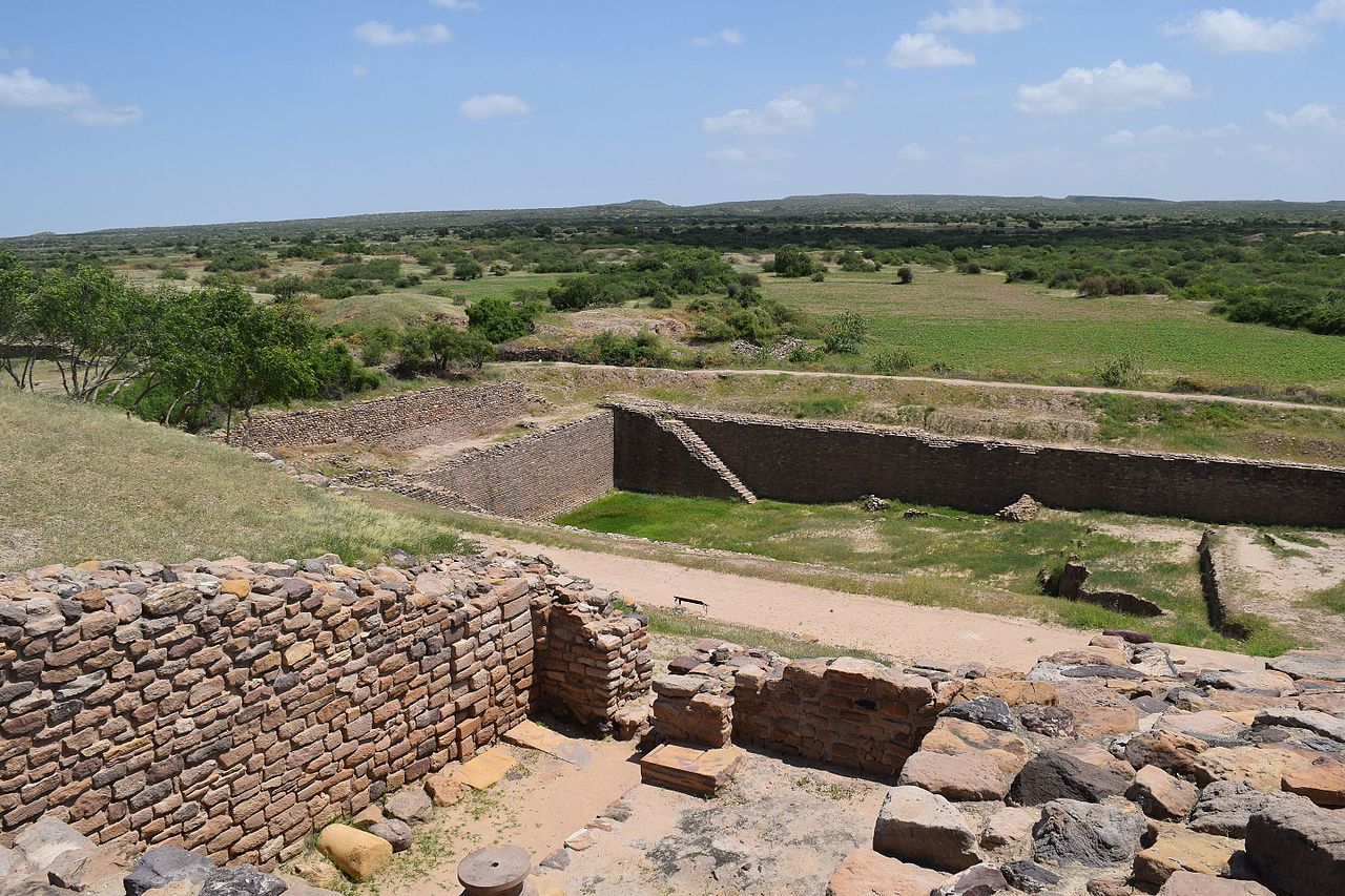
To survive, Dholavira's engineers designed one of the most elaborate water management systems of the ancient world. They constructed at least sixteen reservoirs within the city's 47-hectare fortified area. These were not simple ponds; they were large-scale, engineered structures, some carved directly into the bedrock and others built with stone masonry. The reservoirs were interconnected, forming a cascading system that took advantage of the natural 13-meter slope of the terrain from northeast to northwest. This gravity-fed network allowed water to be channeled and stored systematically across the settlement. The total storage capacity of this network is estimated to have been around 250,000 cubic meters. The largest identified reservoir, the East Reservoir, measures approximately 73 meters long, 30 meters wide, and 10 meters deep.
Hydraulic mastery in stone
The system for collecting water was as complex as the storage. Engineers built a series of check dams on the Mansar and Manhar streams to slow the monsoon floods and divert water into the city. A network of large, stone-lined drains and channels, some tall enough for a person to walk through, directed the captured water toward the reservoirs. The infrastructure shows an understanding of hydraulic principles. The channels had calculated gradients to control flow, and some evidence suggests the use of sedimentation techniques to manage water quality.
The entire urban plan of Dholavira was organized around this water system. Reservoirs were not an afterthought but an part of the city's layout, with nearly a third of the fortified area dedicated to water storage. Unlike other Harappan sites such as Mohenjo-daro which relied heavily on wells, Dholavira’s saline groundwater made this option unviable, forcing an almost complete dependence on harvested surface water. The construction reflects an advanced knowledge of materials, with extensive use of stone blocks and interlocking brick technology. This system supported a substantial population, with some estimates ranging between 20,000 and 40,000 people during its peak. The final decline of the city around 1900 BCE is linked to severe climate change and prolonged droughts that even this sophisticated system could not overcome.