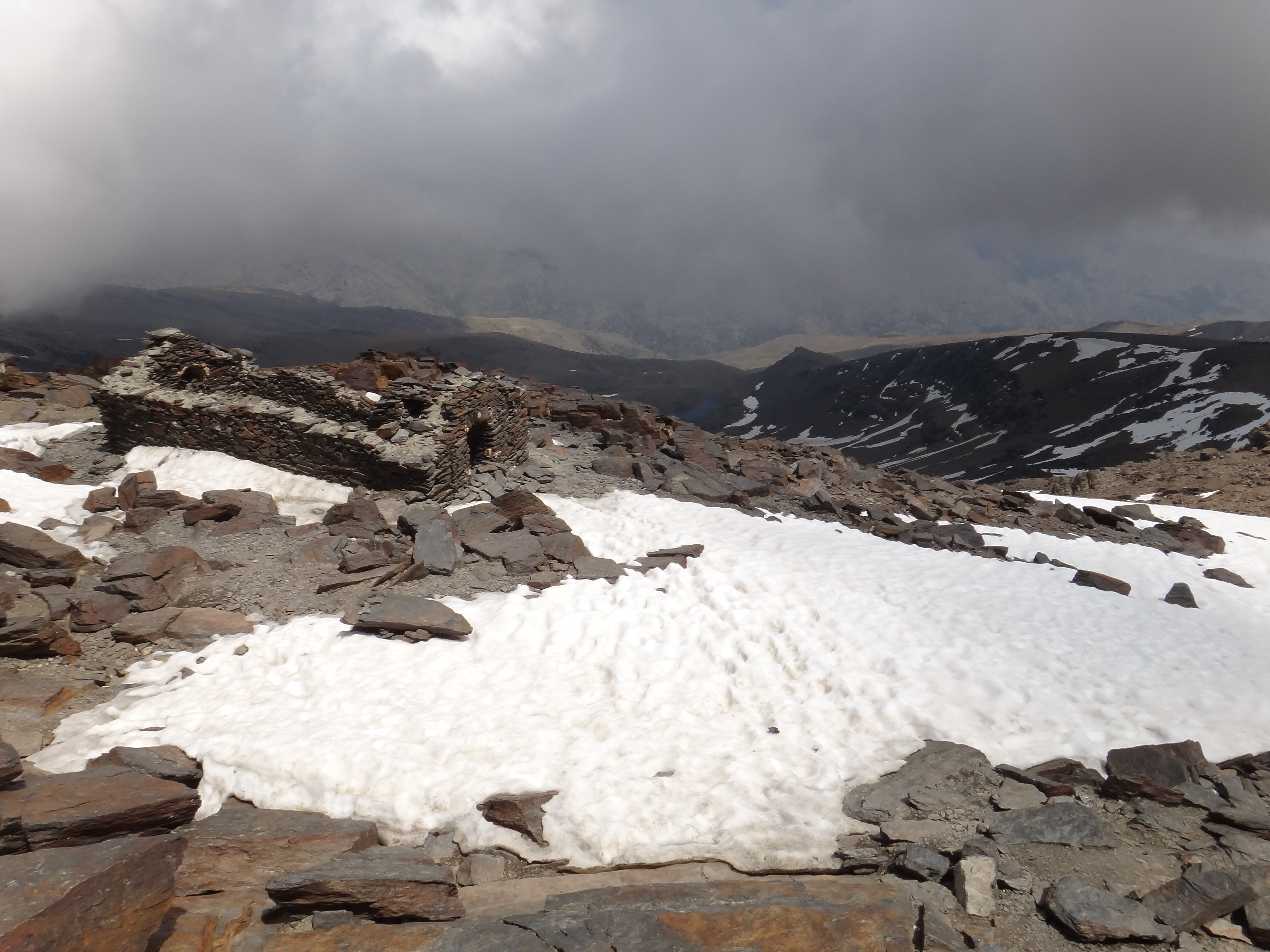
Iberia's highest peak showing periglacial activity. Frost heave measurements show ground surface rises 5cm each winter as ice lenses form in soil, then settles in summer, slowly sorting rocks into polygonal patterns.
Hans Braam, CC BY 3.0
A relic of the ice age
The summit of Mulhacén, at 3,479 meters, is the highest point on the Iberian Peninsula. It also contains an unusual geological feature for southern Spain: patches of permafrost. This permanently frozen ground remains from colder past climates, particularly the Little Ice Age, which occurred from the 14th to the 19th centuries. Research confirms that widespread permafrost does not exist in the Sierra Nevada today; instead, seasonal frost is the dominant process above 2,500 meters.
The small, isolated patches of permafrost are confined to the cirques of Mulhacén and the neighboring peak, Veleta, at elevations above 3,000 meters. This frozen ground survives under thick layers of debris which insulate it from summer warmth. Monitoring of the ground on the highest plateaus, between 3,300 and 3,400 meters, shows that the mean annual soil temperature is around 2.5°C, too warm for permafrost formation under current conditions. The surviving permafrost shows past environmental conditions and ongoing climate change.
The breathing mountain
The most dynamic process on Mulhacén's summit is seasonal frost action. Each winter, as temperatures drop, water within the soil freezes into ice lenses. This process, known as frost heave, exerts enough force to lift the ground surface by as much as 5 centimeters. When the ice melts in the spring and summer, the ground settles back down. This annual cycle of lifting and settling drives a slow-motion sorting of the rocky debris on the summit.
Over countless cycles, this frost action organizes the stones into distinct shapes. The surface shows a variety of periglacial landforms, including sorted polygons, stone stripes, and solifluction lobes, where saturated soil slowly flows downslope. This constant, subtle movement shapes the entire high-altitude landscape.
A multi-disciplinary research program, initiated in the early 2000s, actively monitors the frozen ground conditions in Sierra Nevada. Scientists use temperature sensors in boreholes, some drilled deep into the bedrock, and precise geomatic surveys to track the subtle changes in the mountains' surface. Data from these studies show that the active layer, the ground that freezes and thaws annually, can be between 0.6 and 2 meters thick, depending on the year's climate conditions.
💡Fun Facts
Mulhacén holds the southernmost remnants of glacial ice and permafrost in Europe.
The mountain is named after Muley Abul Hassan, the second-to-last Nasrid king of Granada in the 15th century, who, according to legend, was buried on the summit.
The slow, gravity-driven movement of rock and soil on the slopes, lubricated by ice, is called solifluction.
On clear days, the view from the summit can extend across the Mediterranean Sea to the Rif mountains of Morocco.
Open 24/7, but access is entirely dependent on weather and snow conditions. The climbing season is typically from late spring to early autumn.
Admission
Free to enter the National Park and climb the mountain. Costs may apply for bus services or guided tours.
Accessibility
The summit is reached via a strenuous, high-altitude hike over rocky and uneven terrain. It is not accessible to people with mobility issues. The final ascent involves a significant elevation gain of over 800 meters.