A river's disappearing act
The Turgay River carves an 825-kilometer path through the vast, semi-arid steppe of the Turgay Depression in northern Kazakhstan. For most of the year, large sections of its channel are dry. The river's existence depends almost entirely on the spring thaw of winter snows. This single pulse of meltwater is often the only significant flow the river sees. In recent years, this pulse has weakened, showing regional climate change.
Historically, the Turgay's spring flood would travel its full length and empty into the Shalkarteniz, a large, endorheic (terminal) salt depression. Now, that journey is rarely completed. Warmer springs cause rapid evaporation, while reduced winter snowpack and earlier thaws mean less water enters the channel to begin with. Much of the meltwater now soaks into the thawing ground instead of contributing to river flow. The result is a ghost river. Its flow often vanishes into the steppe soils long before reaching its destination. This transition from a seasonal to an ephemeral river system documents a landscape becoming progressively drier.
A landscape shaped by water and time
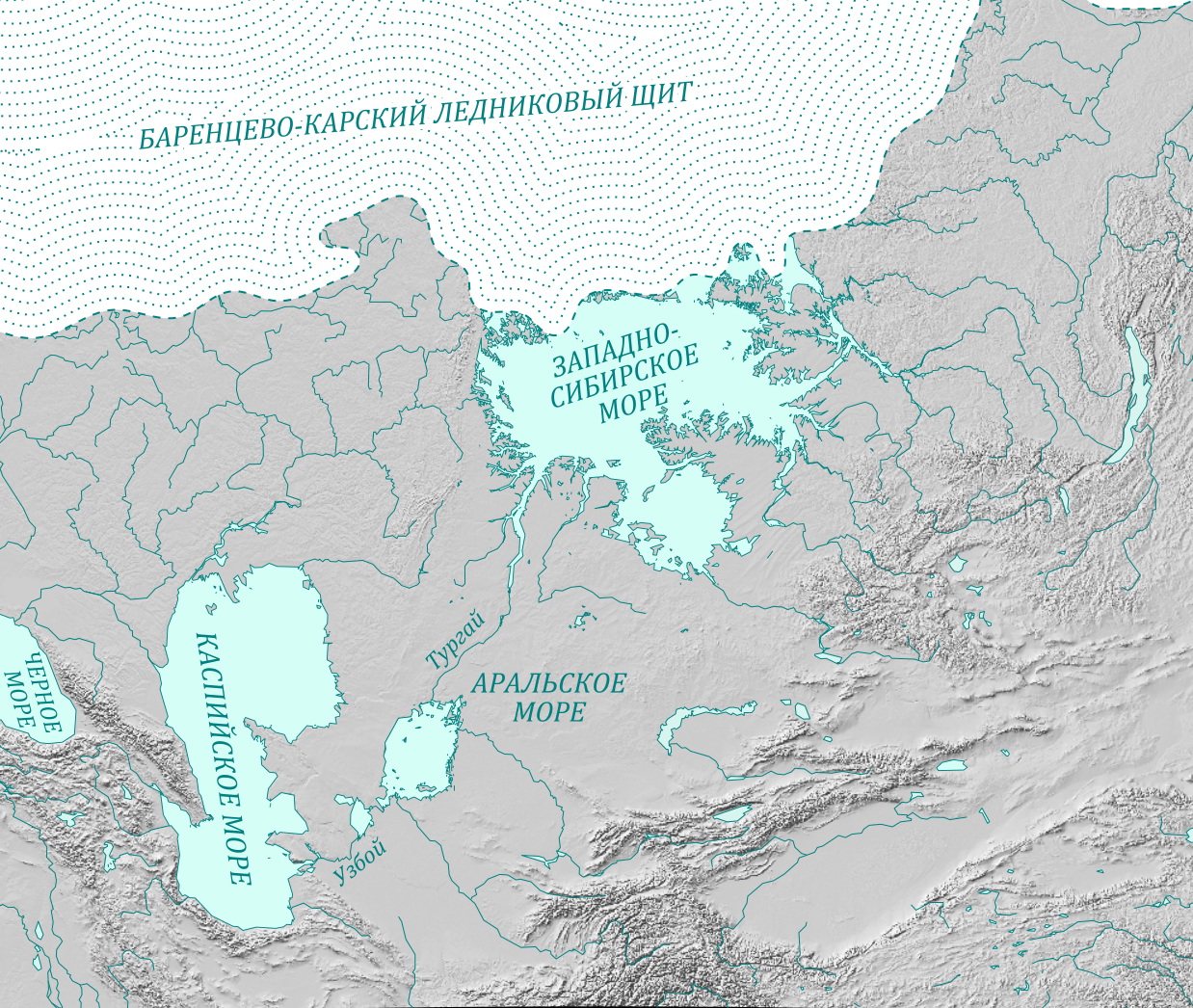
The Turgay Depression, through which the river flows, is a massive geological feature that tells a story of much wetter times. During the Ice Age, it was a spillway for glacial meltwater flowing from the West Siberian Plain. Even earlier, during the Cretaceous and Paleogene periods, it was a true seaway called the Turgai Strait, connecting the ancient Tethys Ocean with the Arctic and separating Europe from Asia.
Today, the river basin is an important habitat. The Naurzum Nature Reserve, a UNESCO World Heritage site, is located within the river's drainage basin. The wider valley, with its chain of freshwater and saline lakes, forms an important migration corridor for millions of birds traveling between Siberia and their southern wintering grounds. The diminishing flow of the Turgay directly threatens these wetlands, which depend on the seasonal floods to be replenished. The increasing salinity of the lower river reaches during dry periods further alters these delicate ecosystems.
The region also holds mysteries of human history. Scattered across the Turgay Trough are at least 260 massive earthworks known as the Turgai geoglyphs. These enormous squares, crosses, rings, and swastika-like figures, some over 400 meters in diameter, are visible from space and may date back 8,000 years. Their purpose remains unknown, but their existence points to ancient activity in this now sparsely populated landscape.