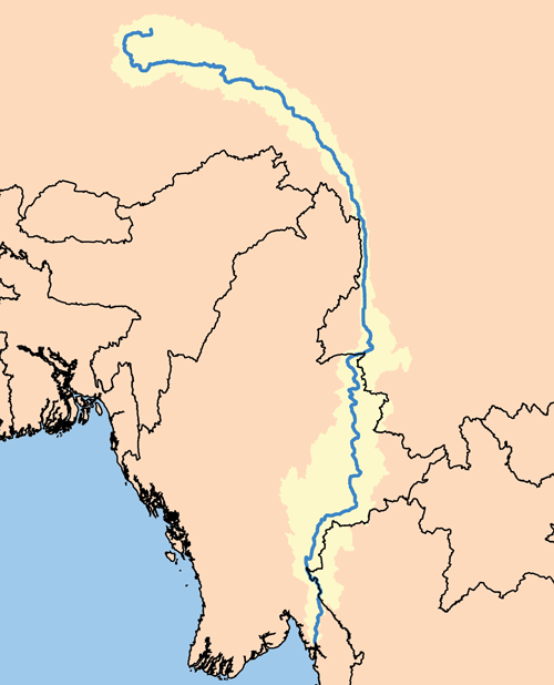
Proposed dams on the Salween sit in earthquake zones. Paleoseismic trenching revealed fault ruptures within the past 1,000 years that could devastate any dam built here.
No machine-readable author provided. Kmusser assumed (based on copyright claims)., CC BY-SA 2.5, via Wikimedia Commons
A Tectonically Active Collision Zone
The Salween River, one of Southeast Asia's last major free-flowing rivers, courses through a region of intense geological activity. Myanmar sits at the complex junction where the Indian Plate grinds northwards into the Eurasian Plate. This collision drives motion along major fault lines that slice through the country. The most important of these is the Sagaing Fault, a right-lateral strike-slip fault that extends for over 1,200 kilometers and accommodates a large portion of the tectonic strain.
Plans for a series of hydroelectric dams on the Salween, including the 1,360-megawatt Hatgyi Dam in Kayin State, place massive infrastructure directly within this seismically hazardous environment. The Hatgyi Dam site is located approximately 47 kilometers from the Thai-Myanmar border in an area of ecological and ethnic variety. While the major Sagaing Fault lies further west, other active fault lines, such as the Nampawng and Nam Ting faults, are in close proximity to proposed dam locations. Geological studies have confirmed that the broader region has a history of powerful earthquakes, including events of magnitude 7.0 or greater.
Reading the Ruptures
Scientists use a technique called paleoseismology to understand the earthquake history of a region where written records are sparse. By digging trenches directly across a fault line, geologists can read the layers of soil and rock. Displaced or folded layers reveal ancient surface-rupturing earthquakes. Studies along the Kyaukkyan Fault, another major fault system in eastern Myanmar, have used this method to identify multiple ruptures. Radiocarbon dating of organic material within these trenches showed evidence of a powerful earthquake that occurred sometime after 1270 ± 30 BP (Before Present).
This evidence of recent, significant seismic activity within the last millennium is an issue for dam construction. Beyond the risk of a natural earthquake, the immense weight of water in a large reservoir can itself trigger seismic events, known as reservoir-induced seismicity. Chinese earthquake specialists have specifically warned that the weight of a reservoir above a fault line is likely to trigger earthquakes, a primary reason why dam projects on the upper Salween (Nu River) in China were suspended. A dam failure at a site like Hatgyi could release a catastrophic volume of water, endangering downstream communities and ecosystems.
💡Fun Facts
The Salween River originates in the Tibetan Plateau and flows for 2,800 kilometers to the Andaman Sea, supporting around 10 million people.
The Sagaing Fault is a right-lateral strike-slip fault, meaning the land on the opposite side of the fault moves to the right during an earthquake. It moves at a rate of about 18-22 millimeters per year.
The Salween River basin is a biodiversity hotspot with 42 species on the IUCN Red List of Threatened Species and many plants and animals used by local Karen people for food and medicine.
The proposed Hatgyi Dam would flood parts of two wildlife sanctuaries.
This is not a tourist destination. The proposed dam site is in a remote, mountainous region that has been an active conflict zone. Access is restricted and dangerous.
Admission
Not applicable.
Accessibility
The terrain is rugged and undeveloped. The area has a history of military conflict, and travel is not advised.