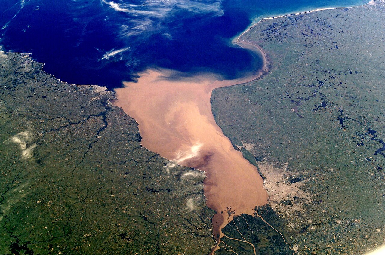
An estuary of continental scale
The Río de la Plata is the widest river estuary in the world, reaching a maximum width of 220 kilometers at its mouth. It is a massive funnel-shaped indentation on the South American coast, formed by the meeting of the Paraná and Uruguay rivers. The estuary's drainage basin covers an immense 3,170,000 square kilometers, including parts of Argentina, Bolivia, Brazil, Paraguay, and Uruguay.
The estuary itself is a geologically young feature. During the last glacial maximum, when sea levels were much lower, this area was a wide river valley. As the ice sheets melted and sea levels rose, the Atlantic Ocean flooded the valley, a process known as a marine transgression. This event, which began around 11,700 years ago, created the modern estuary. The entire basin is shallow, with depths in the inner freshwater zone ranging from only one to five meters.
The combined flow of the Paraná and Uruguay rivers discharges an enormous volume of freshwater into the Atlantic, with an average of about 25,000 cubic meters per second. This freshwater carries a tremendous amount of suspended sediment; an estimated 57 to 100 million tons per year. This constant influx of material is actively filling the ancient river valley.
Reading the red layers
High-resolution seismic profiling, a technique that uses sound waves to image layers beneath the riverbed, reveals the history of this infilling. The data show a deposit of Holocene-era sediments up to 100 meters thick, all laid down since the end of the last ice age. These recent deposits sit atop a much older surface from the Pleistocene epoch. The seismic profiles also reveal buried paleochannels—the courses of ancient rivers that once flowed across the valley floor and are now entombed in mud.
Much of this sediment has a distinctive reddish-brown color. The primary source of this material is the Bermejo River, a major tributary of the Paraguay River, which in turn flows into the Paraná. The Bermejo's headwaters are in the Andes mountains, where it erodes iron-rich soils, giving the water its characteristic color. This river alone contributes about 100 million tons of fine sediment to the system annually.
The constant deposition creates large, shifting shoals and sandbars throughout the estuary, such as the Barra del Indio, which separates the inner freshwater zone from the outer brackish waters. This sedimentation requires constant dredging to keep the shipping channels to major ports like Buenos Aires and Montevideo navigable.