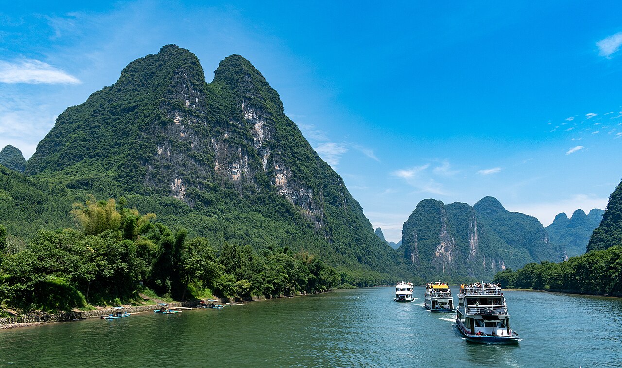
The famous towering limestone peaks along the Li River are a result of extreme karstification, where soluble bedrock was eroded by groundwater over millions of years, creating a region that inspired ancient Chinese art.
xiquinhosilva, CC BY 2.0, via Wikimedia Commons
A Seafloor Reaches for the Sky
The dramatic pillars of the Li River landscape began their story around 300 million years ago as a seabed. During the Devonian and Carboniferous periods, marine sediments accumulated and compacted into a thick layer of limestone, in some areas up to 3,000 meters thick. Tectonic movements, culminating with the collision that formed the Himalayas, uplifted this massive limestone block. For the last 40 million years, this former seafloor has been exposed to the elements.
The region's warm, wet climate is an engine for creating karst topography. Rainwater absorbs carbon dioxide from the atmosphere and soil, forming a weak carbonic acid. This acid reacts with the calcium carbonate in the limestone, slowly dissolving the rock. This process of dissolution carved out a vast network of underground rivers and caves. Over millions of years, as the rock mass was carried away molecule by molecule, the most resistant portions remained, forming the towers seen today.
Towers, Cones, and Caves
The Li River shows two classic types of mature karst landscapes: Fengcong (cone karst) and Fenglin (tower karst). Fengcong appears as clusters of conical peaks that share a common base, representing an earlier stage of erosion. Fenglin, the more common formation, consists of isolated, steep-sided towers rising from flat alluvial plains. These are "solution pillars"—the parts of the landscape left behind after the majority of the limestone dissolved and was washed away by the river.
This erosion also created extensive subterranean systems. The Reed Flute Cave, a well-known example, is a 240-meter-long cavern filled with stalactites and stalagmites that have been forming for over a million years. Inscriptions found on the cave walls date back to the Tang Dynasty in 792 AD, showing humans have been visiting these geological wonders for centuries. The entire landscape shows karst evolution, where surface and subsurface erosion work together to sculpt the land.
💡Fun Facts
The scenery of the Yellow Cloth Shoal on the Li River is depicted on the back of China's 20 Yuan banknote.
The name Guilin literally translates to "Forest of Sweet Osmanthus" because of the large number of fragrant osmanthus trees in the city.
Reed Flute Cave gets its name from the reeds that grow at its entrance, which can be made into flutes.
One of the formations inside Reed Flute Cave is a large stone pillar that bears a resemblance to the Statue of Liberty.
The landscape is a natural area; river cruises, the most common way to see the pillars, typically depart between 9:00 and 9:30 AM.
Admission
Access to the region is free, but boat tours have a fee. Prices vary by the type of boat (3-star vs. 4-star) and tour operator.
Accessibility
The river cruise boats are generally accessible, with comfortable seating and observation decks. The surrounding terrain away from the river is steep and not easily accessible.