A landscape in motion
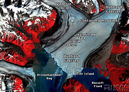
In the vast wilderness of Kluane National Park and Reserve, the ice is not static. This region, part of the world's largest non-polar icefield, contains North America's highest concentration of surging glaciers. Unlike typical glaciers that creep forward steadily, these rivers of ice alternate between long periods of slow movement, known as the quiescent phase, and brief, dramatic surges where they can advance up to 100 times their normal speed.
During a surge, which can last from one to three years, the glacier's toe can advance several kilometers in a matter of months. The Steele Glacier, for instance, surged in 1966-67, moving over 1.5 billion tonnes of ice at speeds up to 15 meters per day. This rapid movement is not due to new ice accumulation but rather a rapid transfer of existing ice from a "reservoir zone" to the glacier's terminus. The mechanism is thought to be linked to the buildup of water at the glacier's base, which reduces friction and allows the ice mass to slide forward. The surface of the glacier becomes a chaotic jumble of crevasses and ice cliffs. The Donjek Glacier, for example, has surged eight times since the 1930s, with flow speeds reaching 1,500 meters per year.
The Lowell Glacier's violent history
The 65-km-long Lowell Glacier shows the power of a surging glacier's power. Periodically, its advance has been so swift that it pushes across the Alsek River valley, blocking the river's flow and creating a massive body of water called Neoglacial Lake Alsek.
This has happened multiple times over the past few thousand years. The most recent major damming event occurred around 1850. The resulting lake was immense, extending back to flood the area where the village of Haines Junction now stands. When the ice dam inevitably failed, the lake drained in about two days. The outflow was catastrophic, with a flow rate comparable to the Amazon River. This event, known as a jökulhlaup or glacial lake outburst flood, scoured the landscape, leaving behind giant gravel ripples that are still visible today along the park's Alsek Trail. This history is recorded in the geology but also in the legends and stories of the Southern Tutchone First Nation people. While smaller surges and partial damming have occurred more recently, including in 1952 and 2009-2010, they have been less extensive.