A 360-million-year-old geological event
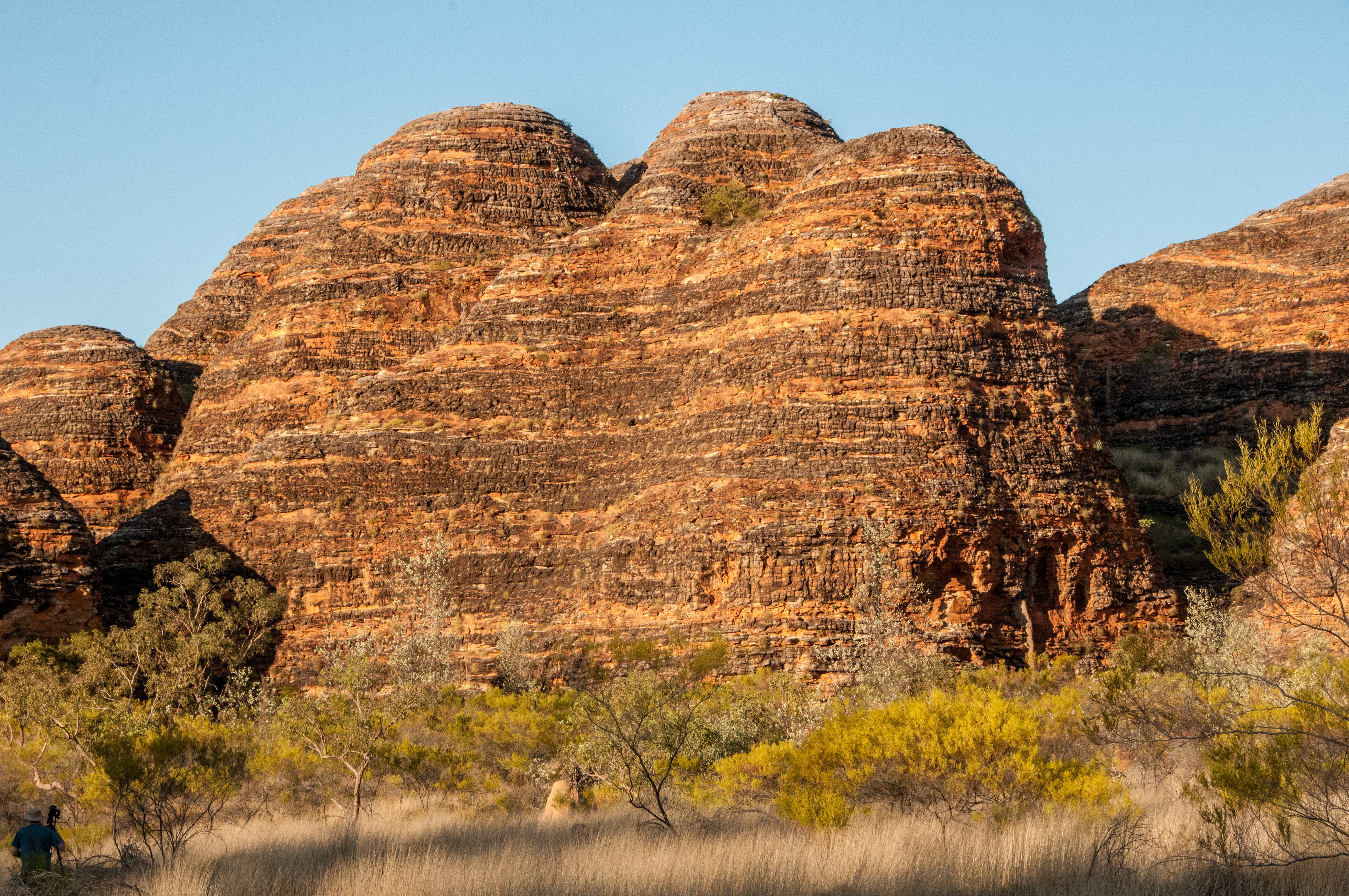
The beehive-like domes of the Bungle Bungle Range are composed of Devonian-age quartz sandstone. This rock formed from sediments deposited by ancient riverbeds around 360 million years ago. Tectonic plate movements later lifted this massive block of sandstone to form a plateau. For the last 20 million years, wind from the Tanami Desert and intense seasonal rainfall have been eroding this plateau, carving out the hundreds of conical towers visible today. Some of these domes rise up to 250 meters above the surrounding grasslands.
The range is a example of sandstone cone karst, a landform whose formation is still not completely understood by geomorphologists. The striking orange and black bands are the result of a interaction between water, rock porosity, and microscopic life. The dark grey or black bands are a surface layer of cyanobacteria, some of the oldest forms of life on Earth. These organisms grow on layers of sandstone that have a higher clay content, which allows them to retain moisture for longer. This thin bacterial crust, just a few millimeters thick, creates a protective shield that slows erosion. The orange bands are layers of more porous sandstone that dry out too quickly for the cyanobacteria to survive. On these layers, iron and manganese compounds in the rock oxidize, or rust, staining the surface with its distinct color.