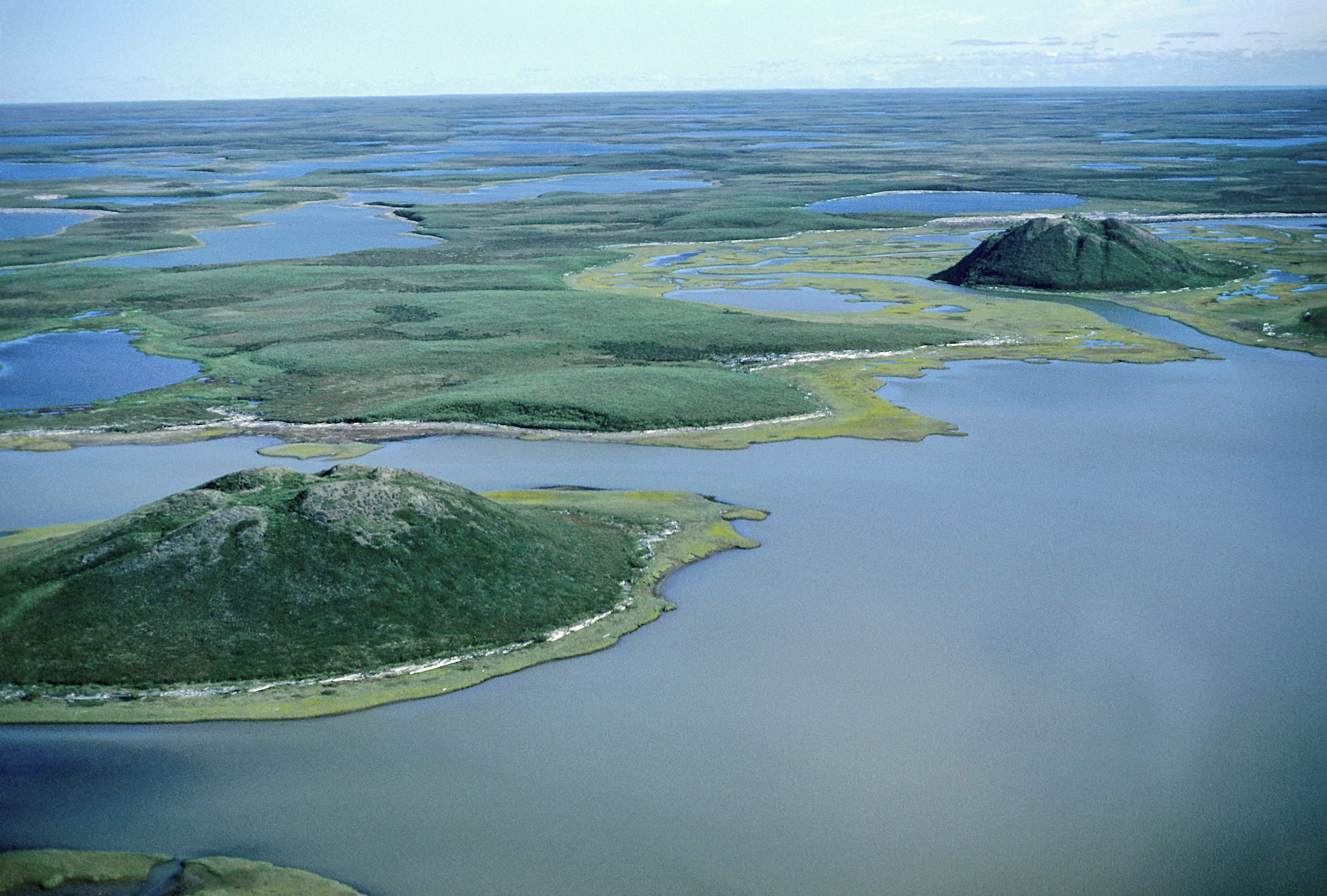
Hills of solid ice
On the flat tundra of the Tuktoyaktuk Peninsula, dozens of conical hills punctuate the landscape. These are not ordinary hills of rock and soil; they are pingos, mounds with massive cores of solid ice. The Tuktoyaktuk region contains the world's highest concentration of these formations, with approximately 1,350 in total. The Pingo Canadian Landmark, a 16-square-kilometer protected area, includes eight of these structures, including Canada's tallest, Ibyuk Pingo. Ibyuk stands 49 meters high—about the height of a 15-story building—with a base 300 meters in diameter.
The pingos here are almost all "closed-system" or hydrostatic types. They form in the beds of former lakes. Arctic lakes often do not freeze to the bottom, creating a lens of unfrozen, water-saturated sediment called talik, insulated from the surrounding permafrost. When a lake drains, this insulation is lost. The surface begins to freeze, and permafrost advances inward, squeezing the trapped water. Unable to escape, the pressurized water pushes upward, heaving the overlying layer of frozen ground into a dome. This process is slow; Ibyuk Pingo grows only about 2 to 2.3 centimeters per year and is estimated to be around 1,300 years old.
A landscape in motion
The life of a pingo is growth and collapse that can last for more than a thousand years. Growth continues as long as there is unfrozen water to feed the ice core. Once the entire core is frozen solid, the pingo's vertical growth stops. At this stage, the mound is a solid lens of ice covered by a thin, insulating layer of earth and tundra vegetation.
This protective layer is fragile. As the ice core expands, it can create tension cracks and fissures at the summit. If this cover is breached, the ice core is exposed to summer sun and begins to melt, causing the pingo to collapse from within. The process leaves behind a ring-like ridge of earth surrounding a central pond, a pingo scar that is the final stage of its life cycle. The landscape around Tuktoyaktuk shows pingos in every stage of this slow-motion process, from young, growing mounds to ancient, collapsing craters. For centuries, the Inuvialuit have used the prominent hills as navigational aids across the tundra and as lookouts for spotting caribou or whales.